

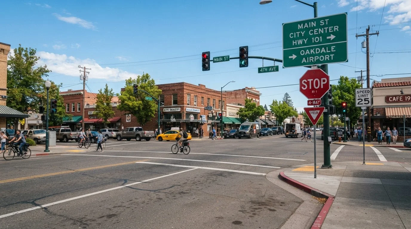
How U.S. Traffic Signs Are Organized
Every sign on an American road follows a system established by the MUTCD - the Manual on Uniform Traffic Control Devices, published by the Federal Highway Administration. This federal standard defines the shape, color, and meaning of every sign type, ensuring that a driver from Maine reads the same message as one from Arizona.
Traffic signs fall into three primary categories: regulatory (what you must do), warning (what hazard lies ahead), and guide (where you are and how to get where you're going). A fourth category - informational and construction signs - covers special conditions such as work zones and school zones. Understanding which category a sign belongs to is the first step in reading it correctly.
For a broader look at road markings that work alongside signage, see what yellow road lines are really telling you.
Regulatory Signs: Commands You Must Follow
Regulatory signs carry the force of law. Ignoring them can result in traffic violations, accidents, or both. They are typically white with black, red, or green text and symbols.
- Stop (red octagon): Come to a complete halt before the stop line or crosswalk. Proceed only when it is safe and legal to do so.
- Yield (red-bordered downward triangle): Slow down and give the right-of-way to conflicting traffic. You must stop if necessary. See how yield logic works in roundabouts for a common application.
- Speed Limit (white rectangle): Sets the maximum legal speed under normal conditions. Advisory speed plates beneath a sign suggest safe speeds for specific features like curves.
- Do Not Enter / Wrong Way: Prohibits entry into a roadway or lane - most often found at highway ramps and one-way streets.
- No Turn on Red: Overrides the general permission to turn right on red where pedestrian or traffic conflict is high.
- Lane-use signs: Arrows indicate which movements are permitted or required from a given lane.
Warning Signs: Hazards Ahead
Warning signs are yellow diamonds (or occasionally orange in work zones) with black symbols or text. They alert drivers to conditions that require a change in speed or behavior - but carry no direct legal mandate to stop or yield.
MUTCD
The Manual on Uniform Traffic Control Devices, the federal standard published by the FHWA that defines the design, placement, and meaning of all traffic signs, signals, and markings on U.S. public roads.
Regulatory sign
A sign that communicates a legal requirement. Drivers are obligated to obey regulatory signs, and violations can result in traffic citations.
Warning sign
A sign alerting drivers to a potential hazard or change in road conditions ahead. Warning signs recommend caution but do not by themselves impose a legal duty to stop or yield.
Advisory speed
A suggested speed displayed on a supplemental plate below a warning sign, indicating the recommended safe speed for a specific feature such as a sharp curve or ramp.
Crossbuck
The X-shaped white sign posted at railroad grade crossings. It functions as a regulatory sign requiring drivers to yield to any approaching train.
Grade crossing
Any intersection where a road and a railroad track meet at the same level. Grade crossings are marked with advance warning signs and crossbuck signs at the crossing itself.
- Curve and turn signs: Indicate the direction and severity of upcoming bends. An advisory speed plate below gives a recommended safe speed.
- Intersection ahead: Cross, T, or Y shapes show the configuration of an upcoming junction.
- Pedestrian / School crossing: Pennant-shaped or diamond signs with a walking figure flag areas of high foot traffic.
- Railroad crossing (round, yellow): Warns of an at-grade rail crossing ahead. The crossbuck sign at the crossing itself is a regulatory device requiring you to yield to trains.
- Slippery when wet: A car with wavy skid marks signals reduced traction - relevant in rain, snow, or leaf-covered roads.
- Divided highway begins / ends: Signals where a median starts or stops, changing the traffic pattern ahead.
For rules that apply specifically in high-penalty zones, understand what the law requires in school and construction zones.
Guide and Informational Signs
Guide signs tell drivers where they are, where routes lead, and what services are available. Color and shape encode the type of road:
- Green rectangles: Standard route and distance signs on conventional roads and highways. Exit signs and highway interchanges use this color.
- Blue rectangles: Motorist services - fuel, food, lodging, hospital. Indicate facilities at the next exit.
- Brown rectangles: Recreational and cultural interest sites - parks, historic landmarks, scenic areas.
- Interstate shields (red, white, and blue): Mark numbered Interstate routes. Odd numbers typically run north-south; even numbers run east-west.
- State route markers: Shape and color vary by state but always display the route number.
If you're preparing for high-speed travel, what new drivers should know before their first highway trip covers how to read guide signs under time pressure. For a comprehensive overview of all U.S. driving rules, see Safe Driving in America.